Categories
You are here
Pajares Cavern Excavation Progress
Friday, August 28, 2009

Project Overview
The new Pajares Tunnel is a 25.7 km (15.5 mi) long railway tunnel connecting La Pola de Gordon in Leon with Telledo in Asturias
on the Alta Velocidad Espanola (AVE) high speed rail line fromValladolid to Gijon.
When completed it will be one of the longest rail tunnels in the world.
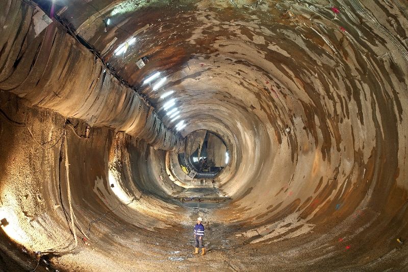
Lot 2 comprises the middle third section of the tunnel and includes a 4 km (2.5 mi) twin bore, 10 m (33 ft) diameter, segmental lined TBM tunnel excavated in rock. The high-strength, pre-cast concrete segments of the lining will have a thickness from 50-60 cm (20 to 24 in).
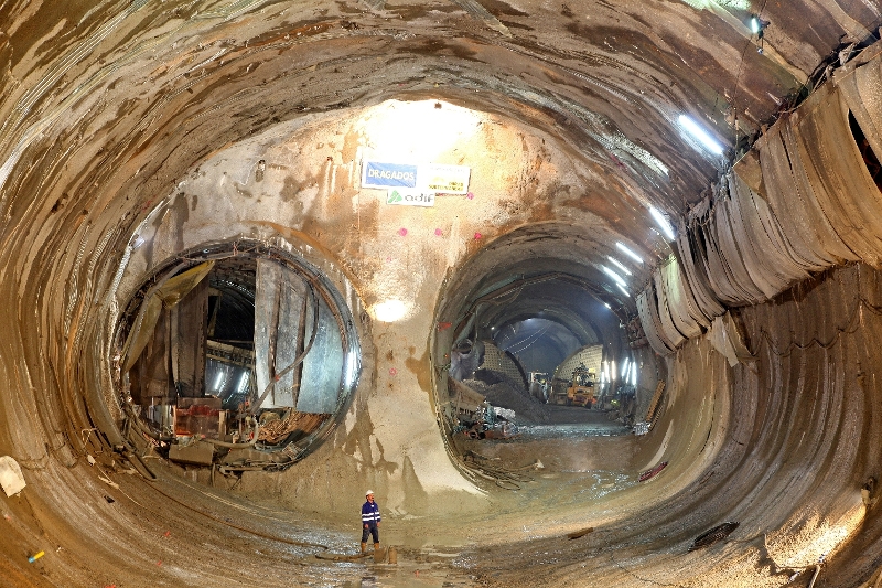
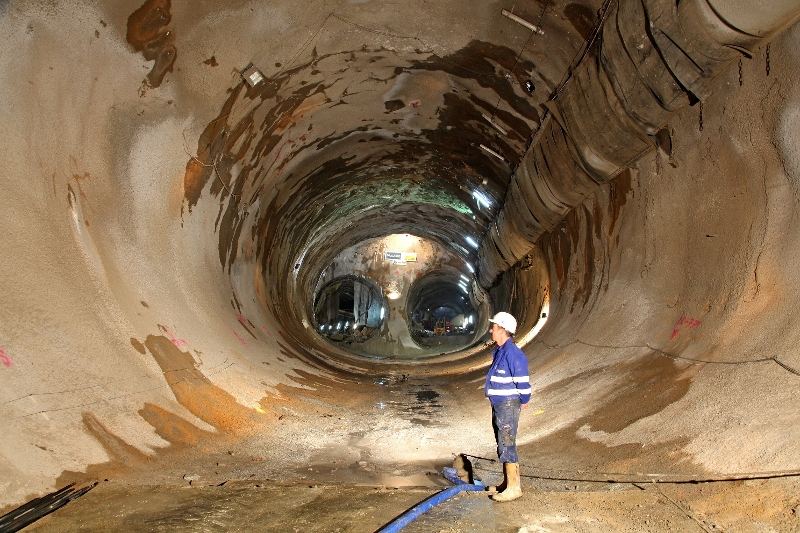
The start of the main tunnel drives of Lot 2 are at the north end of a 5.7 km (3.5 mi) long Access Tunnel running at a 6% grade to a depth of approximately 830m. The connection between the Access Tunnel and the Main Tunnel requires the construction of a largespan Bifurcation Chamber ("Bifurcation East") and a short mined tunnel, which will be both constructed with the New Austrian Tunneling Method by using conventional mining methods such as drill-and-blast and roadheaders.
Geology
The "Formación Láncara" is the predominant geological unit at the location of the Bifurcation Chamber. The formation mainly consists of dolomite, red limestone and grey limestone.
In the excavation boreholes no groundwater has been encountered.
DSC Services
Dr. Sauer Corporation (DSC) performed the detail design of the Bifurcation Chamber, including excavation sequences, final design drawings, initial ground support (rock bolts and shotcrete) and verification of the segmental lining design.
DSC was retained by the contractor to perform 3D Finite Element Analysis for the Bifurcation East, in order to adequately address the stress re-distribution during excavation of the cavern.
During construction, DSC is providing engineering support services, in order to verify the design assumptions based on the information received from site. As new geotechnical field data becomes available, the numerical models are re-run to adapt the required ground support to the conditions actually encountered in the field.
Category